Monday, December 8, 2014

Final Blog

     Along with the wonderful weather and beach, San Diego's physical geography is different than many other places. Due to colliding tectonic plates, San Diego experiences many earthquakes and mountains, some unlike any other.

Southern California is the only place that has two tectonic plates going against each other.
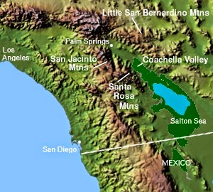

    One of San Diego's unique geography is its tectonic plates. Southern California lies on the Pacific tectonic plate, which is different than much of the United States. But, even though Southern San Diego lies on the Pacific plate, other parts of California lie on the Northern plate. California having two different tectonic plates creates a sliding boundary. This sliding boundary is caused because of the San Andreas Fault, This has made a split in California and has caused the two tectonic plates to slowly grind against eachother and slide past each other a little every year. This fault also causes many minor earthquakes and half of the major earthquakes to happen in the region. Along with earthquakes, sinkholes and landslides also occur because of the tectonic plates clashing against each other. 

This landslide occured in Laguna Beach and destroyed up to 11 homes.

San Diego in 10,000 years, 1,000,000 years, and 100,000,000 years in the future

    There is a big hypothesis that in the future California will experience a major earthquake and will break off and sink under water but, that is not true. The only way this could happen is if the earthquake had a magnitude of 10.5 and the San Andreas was ten times longer than the 800 miles it is. But, I believe having two plates sliding past each other little by little every year will in future cause a change in the geographic location and shape of the state of California. The San Andreas Fault, has already split California into two, in a sense, with the North American plate sliding down and the Pacific Plate sliding up, Because of the plates clashing and grinding together, many earthquakes erupt throughout the region, that sometimes cause landslides. It is said that with every year the rate of slippage with the plates are an average of 1.4 inches. Therefore if this rate of slippage was to continue in the same pace, in 10,000 years the slippage would have resulted in 14,000 inches between the two tectonic plates. In 1,000,000 years, the rate of slippage will result in 1,400,000 inches. Lastly, in 100,000,000 years, if the rate of slippage continues at 1.4 inches every year, then it will be 2,209 miles of slippage that happened. At this point it will be view-able by the normal eye the change of the geographic location of California. Therefore, the idea that California will break off due to some earthquake and sink, is not true. However, instead of breaking off due to an earthquake, California can split and drift away from the US because of the tectonic plates grinding in different directions. As a result, California may drift far enough to be underwater, but to see it drift underwater is something that could happen in 100,000,000 and plus years.

     The geography of San Diego will continue to change in time because of nature/ human made changes. However, with the world evolving the future can change in a positive or negative way, meaning what we predict today can be wrong in the future. 


References
Oskin, By Becky. "What Is The San Andreas Fault?" LiveScience. TechMedia Network, 01 May 2014. Web. 07 Dec. 2014.

"Earthquake Facts & Earthquake Fantasy." Earthquake Facts & Earthquake Fantasy. USGS, 29 Sept. 2014. Web. 07 Dec. 2014.

Thursday, November 13, 2014

Weather

      San Diego is known for its almost perfect weather. The average temperature in San Diego ranges from upper 50's in the summer time to high 70's in the winter time. Precipitation in San Diego is less than 12 inches annually and is mostly in the months of December and March. San Diego, just like Colorado and Arizona, has four seasons as well. So, despite their beautiful weather, San Diego's climate changes throughout the months.  

This photo shows the US average temperatures throughout the year compared to San Diego, which stays in the middle throughout.

      San Diego's climate is known to be microclimate because of this region's topography. Microclimate is when the climate of an area varies depending on location. Some factors that play a part in a place having a microclimate are surface temperature, humidity, wind speed, solar insolation and precipitation. Natural environments play a part in microclimate as well, this can include the topography, soil type, sun exposure and latitude of a region. Throughout San Diego there are hills, mountains, canyons causing the climate of the county to vary depending on location. As a result, an Diego has many climate zones throughout the city. Topography plays a significant factor in the microclimate because it affects the areas humidity, area, or wind speed. For example, the temperature of any ocean or body of water influences the atmosphere in that area. So, because of the Pacific Ocean in San Diego, they experience cool summers and warm winters.
This shows the different areas where the climates are different.
 
This photo demonstrates the different climate zones in San Diego. 


      The coast of San Diego is known to experience marine like climate so in May/June months, its coast is known to be cloudy and gloomy. The thick clouds on top of the ocean coast causes the air in the area to be cool and damp. But, traveling a couple miles east of the ocean, the temperature and the weather can be sunshine and high temperatures. So, even though some parts of San Diego along the coast experiences cloudy weather, there are areas just a little distance away that almost never experiences cloudy weather. 

 
A photo taken of a cloudy day on the coast of San Diego.


Works Cited
"Microclimate." Microclimate. N.p., n.d. Web. 10 Nov. 2014.

Tuesday, October 14, 2014

Rock Formations

San Diego has said to be one of the most active regions in the United States. The San Andreas Fault in San Diego has a very rare tectonic plate activity. The whole process of tectonic plates colliding and producing subduction, creates the magma that comes up and erupts from the Volcano. Lava erupting from the volcanoes and flowing down to land affects the kinds of rocks that are on the earth's surface.
This picture shows the lava flowing down on the surface and the magma that is deep in the Earth's crust.
There are three general types of rocks, igneous, sedimentary and metamorphic. Metamorphic rocks are formed when they are exposed to heat or pressure that causes a physical or chemical change in them. Sedimentary rocks are formed when the process of weathering and erosion happens, in a physical/chemical process. Igneous rocks are formed when they come in contact with lava and can be formed either above or underground.
 
This picture is of the Rock Cycle which is the process of rocks being created, changed, destroyed and then created again.
Centuries ago, lava that erupted from the Volcanoes of the Ring of Fire along the Pacific Coast, had caused many igneous rocks to form. The lava caused some extrusive igneous rocks to form, but, it had also allowed some rocks to stay under the surface and cool. The magma going under the Earth's surface cools slower, creating intrusive igneous rocks like sills or dykes.
This image shows where the different intrusive igneous rocks that are formed. It also shows where the extrusive igneous rocks can be formed by the ash and lava.
 However, throughout the years, because of The San Andrea’s weathering and erosion, the intrusive igneous rocks became metamorphosed sedimentary rocks. The plates constantly colliding and building friction, added pressure and heat to the intrusive igneous rocks transforming them to sedimentary rocks.
This map shows the outlining of the Peninsular range

Sedimentary rocks can be seen on these tide pools in San Diego.


            These sedimentary rocks was then pushed up onto huge mountain groups called the Peninsular Range Mountain, which are the part of the San Diego County Mountains. These group of mountains are covered in sedimentary rocks and run north south along the Pacific Coast. Even though the Peninsular Range Mountains stretch along the coast, the Core part of the mountains lie in the San Diego County.
This is the Cuyumaca Mountains in San Diego, which is part of the Peninsular Range Mountains and can get up to 40 inches of rainfall in the upper regions. 


Sources:
"GEOLOGIC CONDITIONS." 3.4 GEOLOGIC CONDITIONS (n.d.): 3.4-.4-10.Sandiego.gov. Draft General Plan, Sept. 2007. Web. 13 Oct. 2014.
Lubowe, Joan. "San Diego Geology." San Diego Hotels. San Diego. Sunbelt Publications, 28 Dec. 2004. Web. 13 Oct. 2014.
"SAVE OUR FOREST AND RANCHLANDS." SAVE OUR FOREST AND RANCHLANDS (n.d.): n. pag. Peninsular Range Wilderness Eco-System. SOFAR. Web. 13 Oct. 2014.
Tauxe, Lisa. "ES10 - EARTH." Igneous Rocks. The Blue Planet, n.d. Web. 14 Oct. 2014.


Tuesday, September 16, 2014

Physical Geography-Tectonic Plates

     San Diego is located in Southern California; north of Mexico and south of Los Angeles. This growing city is in the middle of hills and mesas that start from the Pacific shore all the way east to the Vallecito Mountains. The temperatures of the Pacific Ocean keep the city cool in the summer and warm in the winter time.
This shows the San Diego County limits and all the little cities inside of it.


     Unlike most of the United States, San Diego lies on the Pacific Plate rather then on the North American Plate. Having San Diego and other Southern cities of California lie on the Pacific plate, while other parts of California lie on the North American plate, creates a sliding boundary between the two plates. This sliding boundary is because of the San Andreas fault; this fault is a transform plate boundary, that has made California split into two from the Northern part all the way down to down south of California.
Earthquakes because of  The San Andreas Fault, affects places all through out California. 

     The Pacific Plate is slowly moving in a Northwest direction while sliding against the North Ameican Plate which is moving in a Southeast direction. These tectonic plates are sliding against each other and slowly moving past each other a couple of inches a year. Although this is an average motion rate, there will be years where the plates will not move and instead just push against each other. These Plates, constantly grinding with no room for movement, builds up tensions and the earth's rocks break causing earth quakes.
This shows the two different directions that the Tectonic Plates are going in.

     These tectonic plates colliding have not only caused earthquakes, but have also caused confining forces on both sides of the plates, creating The Transverse Ranges. Unlike most mountain ranges in California that cross north-south, The Transverse Ranges, pivot east-west. The Transverse Ranges are in between San Diego counties and Santa Barbara. These ranges are very steep and make it hard to travel through them.

This photos show The Transverse Ranges in Southern California

References
"Geology of California." Geology of California. N.p., n.d. Web. 16 Sept. 2014.


Saturday, August 30, 2014

     Hello! My name is Luna Abraha. I go to University of Colorado at Denver and I am majoring in Math. I hope to be able to leave a positive footprint on the world or the people around me. I was born in San Diego, California and moved out here when I was a little girl with my family. So although I've been raised in Denver, I still love San Diego and go back there every year. I'd choose the beach over the mountains any day and hopefully one day i'll own a beach house on the coast! (fingers crossed)
     I chose to do San Diego not only because of the beach but because of the beautiful weather and to learn more about the physical geography of the city. There are a lot of hills and canyons that impact the people and the cities so I thought it'd be interesting to learn more about the city I love the most.